自动土壤水分观测数据传输格式及传输方案
- 格式:doc
- 大小:226.00 KB
- 文档页数:21

自动土壤水分观测规范中国气象局综合观测司前言自动土壤水分观测规范分八个章节,包括:自动土壤水分观测的基本任务、观测方法、技术要求以及观测记录的处理方法,观测仪器的工作原理、安装、操作、维护与田间标定方法等内容。
本规范既对自动土壤水分观测仪器生产厂家的设备生产、安装、维护、标校等提出具体要求,又规范台站对仪器的使用方法、明确仪器在标校过程中进行人工对比观测取土的要求,目的是为了使安装在作物地段和固定地段的自动土壤水分观测仪能够顺利投入业务化运行,为农业气象干旱监测服务,发挥项目建设效益。
本规范适用于利用频域反射法(FDR:Frequancy Domain Reflection)原理来测定土壤体积含水量的自动土壤水分观测仪。
本规范由中国气象局综合观测司组织、中国气象局气象探测中心编写,国家气象中心、河南省气象局、湖北省气象局等单位参与了编写工作。
目录前言 (I)第1章总则 (1)第2章观测的一般要求 (1)2.1 观测场地 (1)2.1.1观测地段 (1)2.1.2选址 (1)2.1.3场地建设 (2)2.1.4仪器布设 (2)2.1.5地段描述与记载 (2)2.1.6土壤水文、物理特性的测定 (3)2.2 时制、日界和对时 (3)2.3 计算项目 (3)2.4 仪器性能要求 (3)2.4.1总体要求 (3)2.4.2传感器性能要求 (3)第3章观测仪器 (4)3.1系统结构及工作原理 (4)3.1.1系统结构 (4)3.1.2工作原理 (4)3.2硬件 (4)3.2.1传感器 (4)3.2.2数据采集器 (5)3.2.3系统电源 (5)3.2.4通信接口与通讯模块 (6)3.2.5微机 (6)3.3软件 (6)3.3.1采集软件 (6)3.3.2业务软件 (6)3.4主要功能 (6)3.4.1初始化功能 (6)3.4.2数据采集功能 (6)3.4.3数据处理功能 (6)3.4.4数据存储功能 (7)3.4.5数据传输功能 (7)3.4.6系统管理功能 (7)3.5采样和算法 (7)3.5.1采样 (7)3.5.2算法 (7)第4章仪器安装与维护 (9)4.1基本要求 (9)4.2传感器的安装 (9)4.2.1探针式传感器 (9)4.2.2插管式传感器 (10)4.3电缆的安装与连接 (12)4.4采集器、电源、计算机等的安装 (12)4.5防雷要求 (12)4.6软件安装 (13)第5章传感器标定 (13)5.1传感器标定 (13)5.1.1实验室标定 (13)5.1.2田间标定 (13)5.2业务化检验标准 (14)第6章日常工作、维护与仪器检定 (15)6.1日常工作 (15)6.2维护 (15)6.3值班日志填写 (15)6.4仪器检定 (16)第7章组网传输 (16)7.1组网方式 (16)7.2数据上传原则 (16)7.3数据上传时间规定 (17)第8章自动土壤水分月报表 (17)8.1月报表的编制要求 (17)8.2 自动土壤水分月报表记录处理和编制 (17)8.2.1 土壤水分月记录的处理 (17)8.2.2 缺测处理 (18)8.3自动土壤水分观测记录月报表格式(纸质) (18)8.3.1 月报表的填写规定 (18)8.3.2 自动土壤水分观测记录月报表式样 (19)附录1 人工对比观测记录簿格式 (27)附录2 值班日志格式 (28)附录3 自动土壤水分观测数据文件格式 (31)附录4 自动土壤水分观测站上传数据传输文件格式 (35)第1章总则土壤水分状况是水分在土壤中的移动、各层中数量的变化以及土壤和其它自然体(大气、生物、岩石等)间的水分交换现象的总称。


自动土壤水分观测数据传输格式及传输方案自动土壤水分观测数据传输格式及传输方案中国气象局综合观测司预报网络司2009.8目录1上传文件命名规则 (1)1.1单站文件命名规则 (1)1.2多站文件命名规则 (1)1.3上传文件名说明 (2)2 上传时间规定 (7)2.1数据上传原则 (7)2.2数据上传时间规定 (8)3 上传数据格式 (9)3.1 自动土壤水分观测站上传数据格式 (9)3.2 省级打包上传格式 (14)3.3 作物名称编码表 (15)自动土壤水分观测数据传输格式及传输方案为规范自动土壤水分观测和资料传输业务,确保自动土壤水分观测资料及时、高效地收集、共享和应用,制定本数据传输格式及传输方案。
1上传文件命名规则自动土壤水分观测站上传文件是指自动土壤水分观测站上传至省级气象通信部门或国家气象信息中心的数据文件。
自动土壤水分观测站上传文件包括单站文件命名和多站文件命名两种规则。
1.1单站文件命名规则单站自动土壤水分观测站上传文件命名方式为:Z_AGME_I_IIiii_yyyymmddhhMMss_O_ASM-F TM[-CCx].txt1.2多站文件命名规则多站自动土壤水分观测站上传文件命名方式为(通过省级或国家级打包的文件):Z_AGME_C_CCCC_yyyymmddhhMMss_O_AS M-FTM.txt1.3上传文件名说明(1)文件名称各段说明Z:固定代码,表示文件为国内交换的资料。
AGME:固定代码,表示农业气象资料。
I:固定代码,指示其后字段代码为测站区站号。
IIiii:测站区站号。
区站号使用规则见1.3(2)C:固定代码,指示其后字段编码为编报台字母代号。
CCCC:编报台字母代号,详见1.3.3编报台站代码表。
yyyymmddhhMMss:文件生成时间“年月日时分秒”(UTC,国际时)。
其中,yyyy为年,4位;mm为月,2位;dd为日,2位;hh为小时,2位;MM分钟,2位;ss为秒,2位。

智能农业中的土壤水分监测与灌溉系统设计智能农业的快速发展为农业生产带来了巨大的变革,其中土壤水分监测与灌溉系统设计成为农业领域中的重要组成部分。
本文将探讨智能农业中的土壤水分监测技术以及基于监测结果进行的灌溉系统设计,以期提高农业生产的效益与可持续性。
一、土壤水分监测技术在传统农业生产中,农民通常无法准确了解土壤的水分情况,只能根据经验进行灌溉。
然而,过多或过少的灌溉均会对作物生长产生负面影响,造成资源浪费和产量损失。
智能农业中的土壤水分监测技术能够准确、实时地获取土壤水分信息,为灌溉决策提供科学依据。
1. 传感器技术传感器是土壤水分监测的核心工具之一。
传感器可通过探测土壤中水分含量的变化,提供准确的水分数据。
常见的土壤水分传感器包括电阻式传感器、电容式传感器和频域传感器等。
这些传感器在安装方便、数据准确性高等方面具有优势,可以满足不同农作物的需求。
2. 无线通信技术土壤水分监测需要实时传输数据,以便农民能够及时获取土壤水分的情况。
无线通信技术(例如无线传感网络和LoRaWAN)能够实现传感器与农业管理系统之间的数据传输,使农民可以通过手机或电脑随时监测土壤水分状况。
这种技术的应用为土壤水分监测带来了极大的便利。
二、灌溉系统设计基于土壤水分监测结果的灌溉系统设计可以针对不同农作物和土壤条件,合理安排灌溉方案,以优化农业生产。
1. 灌溉决策算法根据土壤水分传感器采集的数据,灌溉决策算法能够分析土壤水分状况,并制定灌溉方案。
常见的算法包括时域反演法、频域反演法和经验阈值法等。
这些算法可以根据土壤特点和不同农作物的需水量,合理调控灌溉量和灌溉频次,避免浪费水资源并提高灌溉效率。
2. 自动化灌溉系统基于土壤水分监测结果的灌溉系统设计不仅能够进行智能化的决策,还可以实现自动化的灌溉操作。
通过与无线传感网络和执行机构的配合,农民可以远程控制灌溉系统,减轻劳动强度并提高工作效率。
自动化灌溉系统还可以与气象数据和植物生长模型相结合,进行动态调整,以确保农作物的健康生长。

.自动土壤水分观测规范(试行)中国气象局综合观测司前言自动土壤水分观测规范分八个章节,包括:自动土壤水分观测的基本任务、观测方法、技术要求以及观测记录的处理方法,观测仪器的工作原理、安装、操作、维护与田间标定方法等内容。
本规范既对自动土壤水分观测仪器生产厂家的设备生产、安装、维护、标校等提出具体要求,又规范台站对仪器的使用方法、明确仪器在标校过程中进行人工对比观测取土的要求,目的是为了使安装在作物地段和固定地段的自动土壤水分观测仪能够顺利投入业务化运行,为农业气象干旱监测服务,发挥项目建设效益。
本规范适用于利用频域反射法(FDR:Frequancy Domain Reflection)原理来测定土壤体积含水量的自动土壤水分观测仪。
本规范由中国气象局综合观测司组织、中国气象局气象探测中心编写,国家气象中心、河南省气象局、湖北省气象局等单位参与了编写工作。
目录前言 (I)第1章总则 (1)第2章观测的一般要求 (1)2.1 观测场地 (1)2.1.1观测地段 (1)2.1.2选址 (1)2.1.3场地建设 (2)2.1.4仪器布设 (2)2.1.5地段描述与记载 (2)2.1.6土壤水文、物理特性的测定 (3)2.2 时制、日界和对时 (3)2.3 计算项目 (3)2.4 仪器性能要求 (3)2.4.1总体要求 (3)2.4.2传感器性能要求 (3)第3章观测仪器 (4)3.1系统结构及工作原理 (4)3.1.1系统结构 (4)3.1.2工作原理 (4)3.2硬件 (4)3.2.1传感器 (4)3.2.2数据采集器 (5)3.2.3系统电源 (5)3.2.4通信接口与通讯模块 (6)3.2.5微机 (6)3.3软件 (6)3.3.1采集软件 (6)3.3.2业务软件 (6)3.4主要功能 (6)3.4.1初始化功能 (6)3.4.2数据采集功能 (6)3.4.3数据处理功能 (6)3.4.4数据存储功能 (7)3.4.5数据传输功能 (7)3.4.6系统管理功能 (7)3.5采样和算法 (7)3.5.1采样 (7)3.5.2算法 (7)第4章仪器安装与维护 (9)4.1基本要求 (9)4.2传感器的安装 (9)4.2.1探针式传感器 (9)4.2.2插管式传感器 (10)4.3电缆的安装与连接 (12)4.4采集器、电源、计算机等的安装 (12)4.5防雷要求 (12)4.6软件安装 (13)第5章传感器标定 (13)5.1传感器标定 (13)5.1.1实验室标定 (13)5.1.2田间标定 (13)5.2业务化检验标准 (14)第6章日常工作、维护与仪器检定 (14)6.1日常工作 (15)6.2维护 (15)6.3值班日志填写 (15)6.4仪器检定 (15)第7章组网传输 (16)7.1组网方式 (16)7.2数据上传原则 (16)7.3数据上传时间规定 (17)第8章自动土壤水分月报表 (17)8.1月报表的编制要求 (17)8.2 自动土壤水分月报表记录处理和编制 (17)8.2.1 土壤水分月记录的处理 (17)8.2.2 缺测处理 (17)8.3自动土壤水分观测记录月报表格式(纸质) (18)8.3.1 月报表的填写规定 (18)8.3.2 自动土壤水分观测记录月报表式样 (19)附录1 人工对比观测记录簿格式 (29)附录2 值班日志格式 (30)附录3 自动土壤水分观测数据文件格式 (33)附录4 自动土壤水分观测站上传数据传输文件格式 (37)第1章总则土壤水分状况是水分在土壤中的移动、各层中数量的变化以及土壤和其它自然体(大气、生物、岩石等)间的水分交换现象的总称。

智能农业系统中的土壤湿度感知与无线传输技术智能农业系统是利用现代科技手段提高农业生产效率和质量的一种先进农业管理模式。
在这个系统中,土壤湿度感知与无线传输技术是关键的组成部分。
本文将重点探讨土壤湿度感知和无线传输技术在智能农业系统中的应用和作用。
首先,我们来了解一下土壤湿度感知技术。
土壤湿度是指土壤中所含水分的程度,对于农作物的生长和发育至关重要。
传统的土壤湿度检测方法通常是通过人工采样和实验室测试来获取数据,这样往往耗时费力,并且无法实时监测和调整。
而智能农业系统中的土壤湿度感知技术则能够实现自动化、无人化的数据采集和监测。
智能农业系统中常用的土壤湿度感知技术主要有两种:一种是通过传感器感知土壤湿度,另一种是利用遥感技术结合土壤水分反演模型来估计湿度情况。
传感器感知土壤湿度的原理比较简单。
在农田中埋设一定数量的土壤湿度传感器,它们能够实时监测土壤中的湿度情况,并将数据传输到智能农业系统的数据中心。
这样,农民和农业专家就能够随时了解农田中的土壤湿度状况,及时采取措施来灌溉或排水,以确保作物的健康生长。
另一种方法是利用遥感技术结合土壤水分反演模型来估计土壤湿度。
遥感技术通过卫星、无人机等载体获取农田的图像信息,结合土壤水分反演模型来推算土壤湿度。
这种方法不需要手动安装传感器,可以全面覆盖农田,并快速获得大范围的土壤湿度数据。
然而,由于土壤水分反演模型的复杂性,需要进行一定的校正和验证,以确保数据的准确性。
土壤湿度感知技术的顺利应用离不开无线传输技术的支持。
智能农业系统需要将土壤湿度数据传输到数据中心并进行分析处理,无线传输技术能够实现远距离、高速度的数据传输,确保土壤湿度数据的实时性和准确性。
目前,常用的无线传输技术有Wi-Fi、蓝牙、LoRaWAN等。
Wi-Fi技术具有传输速度快、传输距离远等优点,但其信号覆盖范围相对有限,适合用于较小范围的农田。
蓝牙技术传输速度较慢,但适用于设备之间的短距离通信,比如农田中的传感器与智能终端的通信。

/ FM-TS土壤水分自动测定系统(有线型)
(又称:定时定位土壤水分(墒情)自动测定系统)
一、FM-TSC土壤水分自动测定系
统(有线型) 技术参数:
.水分测量范围:0~
100%( m3/m3)
.准确度:±2%
.分辨率:0.1%
.工作环境:-20℃+60℃,0%~100%
.水分测量通道:6路/12路/36路(可根据客户要求扩展)
.存储容量:14万条数据
.供电方式:五号电池、太阳能、蓄电池、220V(可选)
.通讯方式:USB2.0
.软件:上位机软件免费赠送
.采集间隔:1分~24小时任意设置
/ .线缆:标配国标屏蔽线3米(线长可定制)
二、FM-TS土壤水分自动测定系统(有线型)系统特点:
.智能土壤水分自动测定系统,可同时测土壤表层和不同深度的土壤容积含水量,测量精度高,存储容量大,体积小巧,便于携带。
可用于农田、水利、森林、草坪、公路、铁路养护等的长期监测,可连续监测土壤的水分,性能稳定,可靠性高,免维护。
.土壤水分自动测定系统操作简单,性能可靠,全程跟踪记录,记录时间长,具有断电数据自动存储保护功能。
整机功耗小,使用内置五号电池供电,电池供电可达半年以上。
.智能数据采集记录仪可脱离开计算机独立工作,上位机软件功能强大,数据查看方便,随时可以将记录数据导出到计算机中,并可以存储为EXCE表格文件,生成数据曲线,以供其它分析软件进一步进行数据处理,连接计算机可以打印存储数据。
三、FM-TS土壤水分自动测定系统(有线型)应用范围:
.广泛应用于农业、林业、地质、农田、水利、森林、草坪、公路、铁路养护等测等方面的测量及研究。
GStar-I(C)自动土壤水分观测仪使用说明书中国电子科技集团公司第27研究所河南省气象科学研究所2009-09目录一、SDRC型太阳能电源控制器二、蓄电池三、探测器四、数据采集器五、调试软件六、维护与故障排除七、太阳能电池板参数一、 SDRC-10Ⅰ太阳能电源控制器图1 控制器面板图1主要特点:(1) 使用了单片机和专用软件,实现了智能控制;(2) 利用蓄电池放电率特性修正的准确放电控制。
放电终了电压是由放电率曲线修正的控制点,消除了单纯的电压控制过放的不准确性,符合蓄电池固有的特性,即不同的放电率具有不同的终了电压。
(3) 具有过充、过放、电子短路、过载保护、独特的防反接保护等全自动控制;以上保护均不损坏任何部件,不烧保险;(4)采用了串联式PWM充电主电路,是充电回路的电压损失较使用二极管的充电电路降低近一半,充电效率较非PWM高3%-6%,增加了用电时间;过放恢复的提升充电,正常的直充,浮充自动控制方式使系统有更长的使用寿命;同时具有高精度温度补偿;(5)直观的LED发光管指示当前蓄电池状态,让用户了解使用状况;(6)所有控制全部采用工业级芯片,能在寒冷、高温、潮湿环境运行自如。
同时使用了晶振定时控制,定时控制精确。
(7)取消了电位器调整控制设定点,而利用了Flash存储器记录各工作控制点,使设置数字化,消除了因电位器震动偏位、温漂等使控制点出现误差降低准确性、可靠性的因素;(8)使用了数字LED显示及设置,一键式操作即可完成所有设置,使用极其方便直观;(9)具有直流输出或1HZ频闪输出2种输出选择,频闪输出特别适用于LED 交通警示灯等。
2 接线连接(1)先连接控制器上蓄电池的接线端子,再将另外的端头连至蓄电池上,注意+,-极,不要反接。
如果连接正确,指示灯(2)应亮,可按按键来检查。
否则,需检查连接对否。
如发生反接,不会烧保险及损坏控制器任何部件。
保险丝只作为控制器本身内部电路损坏短路的最终保护。


多点土壤水分监测系统多点土壤水分监测系统-多点土壤水分监测系统-多点土壤水分监测系统(HM-TS600)多点土壤水分监测系统土壤墒情与旱情信息管理系统以抗旱减灾为目标,以实时墒情、农情、水利工程蓄水引水情况等信息为数据源,利用先进的土壤水分传感器等先进设备,结合适合地域的数学模型,依托物联网监测平台,建立了集土壤墒情实时监测、信息管理、查询服务为一体的决策支持系统,科学地制定抗旱调度方案,为正确指挥抗旱救灾提供决策支持,最大限度地减轻灾害损失。
1、技术参数★主控制器技术参数·数据存储空间:≥100000条·记录间隔:1分-24小时可调·数据传输:无线传输·工作环境:-30℃~80℃·供电方式:220v市电、太阳能供电系统同时使用★传感器技术参数·空气湿度:0~100%精度:±3%分辨率:0.1%·光照:-20~80℃精度:±2%·雨量:-20~80℃承雨口径:φ200mm精度:±2%分辨率:0.2mm ·土壤水分:测量精度:±3%工作温度范围:-20℃~50℃·土壤ec:测量精度:±4%土壤EC测量范围:0.2~12mS/cm·土壤温度:精度:±0.2℃测量范围:-40℃~120℃2、功能特点◆实时监测风速、风向、空气温度、空气湿度等气象要素参数;◆气象数据记录仪具有气象数据采集、气象数据定时存储、参数设定、参数和气象历史数User第2页2017-4-1◆可靠运行于各种恶劣的野外环境,低功耗、高稳定性、高精度、可无人值守;◆采用全喷塑支架和野外防护箱,外形美观、耐腐蚀、抗干扰。
如何使用智能水务技术分析土壤含水量智能水务技术是目前水资源领域的热门技术之一。
它在保障水资源安全、促进水资源实现优化配置和高效利用等方面发挥着重要作用。
其中,智能水务技术在分析土壤含水量方面有着广泛的应用。
本文将介绍如何使用智能水务技术来分析土壤含水量。
第一步:了解智能水务技术智能水务技术是利用网络、移动通信、传感器、物联网等高科技手段,收集、整理、处理、分析水资源现状、水文环境等方面的信息,以实现对水资源的科学规划、管理调度和防灾减灾等综合利用的信息化技术。
智能水务技术的最终目的是实现水资源优化配置和高效利用。
第二步:确定使用传感器种类智能水务技术采用传感器来检测土壤含水量,一般而言,可使用以下两种传感器:1.电容式传感器 - 电容式传感器是一种利用电容原理感应的电传感器,能够实现对土壤含水量进行精确测量,具有灵敏度高、精度高、稳定性好等特点。
2.阻抗式传感器 - 阻抗式传感器利用土壤含水量的电导率差异实现对土壤含水量的测量,其优点在于结构简单、成本低、使用方便等。
第三步:安装传感器传感器的安装应该考虑土壤含水量的分布、土壤质地、土壤深度、根系生长情况等因素。
传感器应安装在根系生长较为稳定的区域,以保证数据的准确可靠。
第四步:建立传输系统传感器检测到土壤含水量的数据将被传输到数据中心,以便后续处理。
传输系统应考虑传输距离、数据传输方式、传输频率等多个因素。
第五步:分析数据数据分析是智能水务技术的核心内容之一。
收集到的数据应该进行分析,建立土壤含水量的模型,并对模型进行模拟和验证,以最终得出土壤含水量的准确结果。
同时,数据分析也可以为后续的水资源管理提供基础数据。
最后总结:通过以上步骤,智能水务技术可以帮助我们分析土壤含水量,实现对水资源的科学规划、管理调度和防灾减灾等综合利用。
在实际应用中,我们应根据具体情况,灵活运用智能水务技术,同时也可以结合其他科技手段,提高对水资源的利用效率,保障水资源安全。
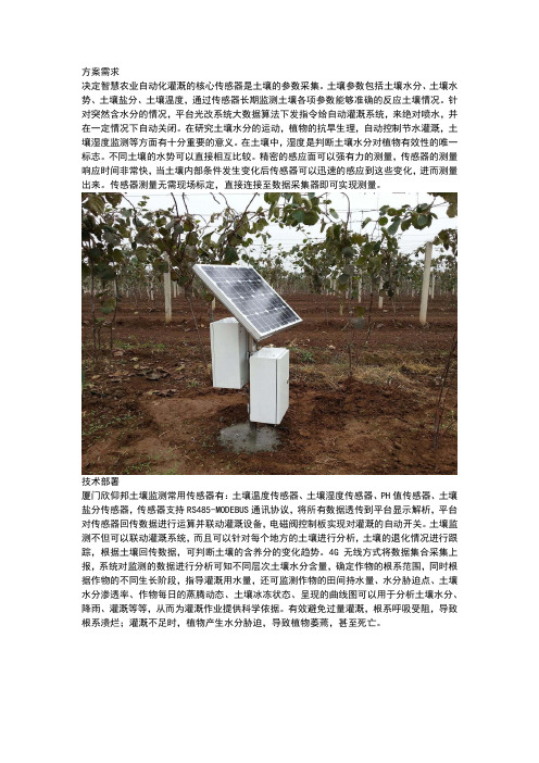
方案需求决定智慧农业自动化灌溉的核心传感器是土壤的参数采集。
土壤参数包括土壤水分、土壤水势、土壤盐分、土壤温度,通过传感器长期监测土壤各项参数能够准确的反应土壤情况。
针对突然含水分的情况,平台光改系统大数据算法下发指令给自动灌溉系统,来绝对喷水,并在一定情况下自动关闭。
在研究土壤水分的运动,植物的抗旱生理,自动控制节水灌溉,土壤湿度监测等方面有十分重要的意义。
在土壤中,湿度是判断土壤水分对植物有效性的唯一标志。
不同土壤的水势可以直接相互比较。
精密的感应面可以强有力的测量,传感器的测量响应时间非常快,当土壤内部条件发生变化后传感器可以迅速的感应到这些变化,进而测量出来。
传感器测量无需现场标定,直接连接至数据采集器即可实现测量。
技术部署厦门欣仰邦土壤监测常用传感器有:土壤温度传感器、土壤湿度传感器、PH值传感器、土壤盐分传感器,传感器支持RS485-MODEBUS通讯协议,将所有数据透传到平台显示解析,平台对传感器回传数据进行运算并联动灌溉设备,电磁阀控制板实现对灌溉的自动开关。
土壤监测不但可以联动灌溉系统,而且可以针对每个地方的土壤进行分析,土壤的退化情况进行跟踪,根据土壤回传数据,可判断土壤的含养分的变化趋势。
4G无线方式将数据集合采集上报,系统对监测的数据进行分析可知不同层次土壤水分含量,确定作物的根系范围,同时根据作物的不同生长阶段,指导灌溉用水量,还可监测作物的田间持水量、水分胁迫点、土壤水分渗透率、作物每日的蒸腾动态、土壤冰冻状态、呈现的曲线图可以用于分析土壤水分、降雨、灌溉等等,从而为灌溉作业提供科学依据。
有效避免过量灌溉,根系呼吸受阻,导致根系溃烂;灌溉不足时,植物产生水分胁迫,导致植物萎蔫,甚至死亡。
方案优点1、传感器体积小,线路长,可不同土壤深度部署;2、RS485-MODEBUS通讯协议支持国际标准平台通信规约;3、多传感器接入,透传平台,接入即可使用;4、无线数据传输方式:GPRS/3G/4G,省去网络布线;5、适用范围广,针对不同的土壤,皆可使用,量程宽;6、支持太阳能取电及多传感器集合采集供电传输一体化;。
DZN2 Automatic Soil Moisture Observation System Based On GPRSTransmissionXue longqin1,2, a, Ye Linmao1,2,b1 Institute Of Meteorology Of Henan Province, Henan, ZhengZhou, 450003, China2CMA Key Laboratory of Agrometeorological Ensuring and Applied Technique,Zhengzhou 450003,ChinaA bKeywords: Soil Moisture, GPRS, Automatic Observation, DZN2Abstract. This article introduces the system of DZN2 automatic soil moisture observation and it’s application in china. The system is mainly made up of automatic collecting device, wireless data transmission system and intelligent data analysis software, and it realizes the automatic collecting for soil moisture, remote wireless transmission, real-time analysis, automatic monitoring and decision support. Meanwhile, the installation of instrument is simple, the maintenance is convenient, the monitoring for soil moisture is continuous and the data precision is high. By these rich and practical functions, business service personnel can quickly analyze the variation trend of soil moisture content in the local area, make a scientific forecast of droughts, and provide technology support for decision-making service of government based on the real-timely collected soil moisture data.IntroductionChina is a country with vast territory, complicated geographic environment and a variety of frequent disastrous weather among which drought is the most widespread and severest. According to statistics, meteorological disasters make up 70% of natural disasters, while droughts account for approximately 50% of meteorological disasters [1]. Droughts bring the most serious impact on agricultural production. In order to respond to the drought-relief work in the new era, Henan Institute of Meteorological Sciences and China Electronics Group-27th Research Institute have jointly designed, researched and developed a automatic soil moisture observation system based on GPRS transmission that can monitors and collects the real-timely soil moisture data quickly and accurately, which not only enhances the time effect of observation,eliminates the manual reading error and relieves the labor intensity of staff in the meteorological stations, but also effectively improves the level of drought monitoring and defense service[2]. In accordance with the principles of simultaneous development of demand pull and business service, meteorological departments have established more than 1000 sets of DZN2 automatic soil moisture observation systems in 12 provinces, municipalities and districts all over the country since 2009, forming an effective soil moisture and drought monitoring network in various regions.Overall Architecture and Functions of SystemDZN2 automatic soil moisture observation system is mainly made up of automatic collecting device, wireless data transmission system and intelligent data analysis software, and it realizes the automatic collecting for soil moisture, remote wireless transmission, real-time analysis, automatic monitoring and decision support. By these rich and practical functions, business service personnel can quickly analyze the variation trend of soil moisture content in the local area, make a scientific forecast of droughts, and provide technology support for decision-making service of government based on the real-timely collected soil moisture data.Design of System HardwareHardware of DZN2 automatic soil moisture observation system is mainly installed in fields tomonitor the soil moisture content of farmlands. In order to meet the need of field installation and application requirements and enable the equipment to operate stably for a long-term, the design of system hardware takes high precision, low power consumption, anti-lighting impulse, anti-moisture, easy installation and maintenance and other factors into account. System hardware includes FDR soil moisture sensor, collector and solar power-supply system.Software of sensor and collector adopts Keil C51 design, which not only has features of general high-level language, but also can directly operate the hardware of SCM system with a stronger expression and computing capability. In addition, it has an efficient code generation and supports float-point number calculation as well as other features.2.1 Soil Moisture SensorSoil moisture sensor is designed on the basis of capacitive transducer and embedded SCM technology. Inside the device is a single-pole multi-section sensor. Each layer of the sensor is composed of two cooper rings, and the moisture variation around sensor results in the medium change of ring capacitor, thus leading to the frequency variation of LC oscillator. The sensor converts the high-frequency signal and then outputs to SCM,which calculates the current volumetric water content of soil moisture based on the established mathematical models and hydrological constants of local soil. Outside the device is a sleeve made of PVC materials, which can prevent water or other fluids from disturbing the internal components and influencing the observation of soil moisture. For the sake of anti-moisture, desiccant is also placed in the sensor.It is stipulated in Automatic Soil Moisture Observation Standard-Interim by China Meteorological Administration that the installation depth and layer of sensor shall be determined on demand. In the agro-meteorological observation, there are generally 8 layers, namely, 0-10, 10-20, 20-30, 30-40, 40-50, 50-60, 70-80, 90-100cm, and the layer of sensor can be adjusted according to observation requirements[3].The currently installed DZN2 automatic soil moisture observation systems are mostly of 1m deep 8-layer structure. In some mountainous areas, the measured depth can't reach 1m due to the thin soil layer; therefore, the observation depth is generally subject to that of soil parent material horizon.DZN2 soil moisture sensor is installed with special tools, without digging holes or destroying soil layer structure. What is needed in maintenance is only to pull out the sensor form the sleeve, hence simple to operate and convenient for instrument calibration.2.2 Soil Moisture CollectorData collector is designed on the basis of single chip microprocessor technology and can send instructions to moisture sensor on a real-time and regular basis as well collect soil moisture data to store. With the mass memory expansion technology, the collector can store two-month punctual volumetric water content of soil moisture, and the data memory inside the collector also has the function of power-down save. The collector supports two types of transmission modes: regular automatic transmission and terminal command responding transmission. Normally, the collector transmits soil moisture observation data once per hour; in case of manual intervention, the collector can also respond to terminal commands at any time and conduct date collection and transmission. The communication between the collector and the soil moisture sensor is realized through RS485 bussing technology, which not only has a strong expansibility but also specially reinforces the anti-lighting design, ensuring the stable operation of equipment and the reliability of data transmission. The communication between the collector and the central station server is realized via wireless communication interface and the data is transmitted via GPRS network. In order to ensure the time synchronization inside the system, the collector not only provides high-precision clock, but also regularly calibrates time with the server terminal every day.2.3 Solar Power-supply SystemThe hardware of automatic soil moisture observation system is mostly installed in fields and has no alternating current power supply, so this system is designed with a solar power-supply system, which is mainly composed of solar panel, storage battery, charge and power supply controller. Its major working modes are like this: when power is supplied by solar energy, the charge controller supplies power for the system and charges the storage battery; when there is no solar power supply,the storage battery supplies power for the system; and when solar energy recovers power supply, the charge controller charges the storage battery until it is full. The solar charge controller is used for automatic charge for maintenance-free lead-acid batteries. It adopts three-stage charging modes with temperature compensation, namely: strong charge-equalizing,charge-floating charge, which is adjusted by pulse width. Solar power-supply system can ensure the normal operation in the extremely severe weather (such as high temperature, low temperature and continuous 7-day rain at most).2.4 GPRS Wireless Data TransmissionGPRS is the abbreviation of General Packet Radio Service; it can achieve rapid access and has such features as full use of existing network, high resource utilization rate, always on line, high transmission rate and reasonable expenses, etc[4]. This system is developed with exclusive GPRS data transmission module, which has such functions as operation mode setting, working parameters setting, data transmission and data reception, etc., and is the key function module for the realization of the wireless data transmission between collecting device and data server.The frequently-used protocols in the GPRS data transmission are UDP protocol and TCP protocol. TCP is Transmission Control Protocol and provides connection-oriented and reliable byte stream service. TCP can ensure the reliable transmission of data by means of such functions as timeout retransmission, repeating data abandoning, data and controlling flow inspecting, etc. UDP is User Datagram Protocol, a simple datagram-oriented transport layer protocol, which doesn’t establish connection before data transmission and has no functions like time-out retransmission, etc. Therefore, its transmission speed is high, but it can’t ensure the reliability of data transmission[5,7].Obviously, compared with UDP, TCP has a complicated transmission and low speed. This system adopts UDP protocol to conduct data transmission and support the server’s remote single station or multi-station data supplementary transmission if any soil moisture data is lost in transmission.Software System DesignThe software of DZN2 automatic soil moisture observation system is composed of data receiving and processing software and business application software. Data receiving and processing software is installed on the data server and includes data receiving and processing system, message ftp transmission system and soil moisture database. Business application software is installed on the terminal computers used by business personnel and service staff, and includes soil moisture data query and analysis system and soil moisture equipment monitoring platform.3.1 Data Receiving & Processing System3.1.1 Data Receiving & Processing SoftwareGPRS data receiving program receives state files and data files of collector sent through GPRS wirelessly at any time, and then the message processing program generates message files according to the requirement of “Data Transmission File Format Uploaded on Automatic Soil Moisture Observation Station” of China Meteorological Administration and saves the data of volumetric moisture content, weight moisture content, relative humidity and effective moisture storage volume, etc. of soil moisture into the database. The generated automatic soil moisture messages will be transmitted to the message server automatically through message ftp transmission system and uploaded to China Meteorological Administration regularly.Meanwhile, GPRS data receiving program can monitor whether the hardware equipment is on line or not, how is GPRS signal strength and whether data is uploaded, etc. and the program can set the parameters of collector and sensor remotely and retransmit the missing data of stations.3.1.2 Soil Moisture DatabaseThe central station Server is established with automatic soil moisture information database and station parameter database. The information of station number, station name, longitude and latitude, altitude, collector address and 10cm-100cm soil hydrological parameters, etc. are saved in the databases, which enables the central station to receive the automatic soil moisture observation data normally and enter them to database.3.2 Business Application Software3.2.1 Automatic Soil Moisture Data Query and Analysis SystemAutomatic soil moisture data query and analysis system can make query and analysis to various soil moisture elements such as volumetric moisture content, weight moisture content, relative humidity and effective moisture storage volume, etc. of 8 layers’ (0-10、10-20、20-30、30-40、40-50、50-60、70-80、90-100cm) soil moisture. The software provides various view modes for each business and service user. Among the modes, soil moisture map can show the soil moisture maps of any layers from 10cm to 100cm of all observation stations in the selected area; multi-layer hourly graph can show the hourly average soil moisture elements of any multi-layer of a certain observation station in the selected area; multi-station hourly graph can show the hourly average soil moisture elements of a certain layer or the average layer of multiple observation stations in the selected area. Flexible setting and querying modes provide timely and reliable data and chart for agricultural meteorological service technical personnel to analyze soil moisture and make service material.3.2.2 Automatic Soil Moisture Monitoring PlatformIn order to maintain the normal operation of the automatic soil moisture observation system in a better way, automatic soil moisture monitoring platform is established to ensure the data reliability of automatic soil moisture observation system and the stability of operation[8,9]. Electronic records of all automatic soil moisture observation equipment are established and the parameter of sensor and collector calibration, detailed information of installation, maintenance and operation, etc. as well as the parameters of each station, soil type, soil parameters are saved in the database. The platform can clearly and timely show whether the device at each station is normal or not, etc. For fault station, the monitoring alarm module will send message automatically to the operator on duty of the station, the principle of the station, city bureau business department, etc. so as to promote the solution of the fault as soon as possible. The equipment maintenance module of the system will record this fault and the fault history can be queried.Calibration & Business Acceptance of Automatic Soil Moisture Observation SystemScientific and accurate calibration is the foundation to ensure the normal business operation of automatic soil moisture observation system [8]. Based on a large number of experimental studies, the mathematical model of soil moisture sensor is established, and through experimental studies on field calibration methods, laboratory calibration methods and direct contrast calibration methods, a four-step calibration method of automatic soil moisture observation instrument is gradually summarized: factory calibration, field calibration, operation calibration and business calibration. When the equipment is installed, make preliminary filed calibration to it according to the local soil type and empirical data and confirm the initial parameters of the sensor; after 6 months’ stable operation of the equipment, get the operation calibration parameters of the sensor according to the parallel observation data and on the basis of the established mathematical models and realize the operation calibration; after 12 months’ stable operation of the equipment, realize the final business calibration according to the parallel observation data and make the measurement accuracy of instrument reach an ideal range. At present, more than 1000 sets of DZN2 automatic soil moisture observation systems have been installed in stations all over the country, of which over 500 sets have passed the business acceptance of China Meteorological Administration and been put into business operation. Other automatic soil moisture observation stations are also performing the work of contrast observation, equipment calibration and data quality evaluation, etc.ConclusionAutomatic soil moisture observation is the revolutionary transformation of agro-meteorological soil moisture observation and the important base for carrying out modern agro-meteorological service. Grasping the variation law of soil moisture is of great importance to agricultural production, drought monitoring and forecasting and other related ecological environment monitoring and forecasting service and theoretical researches [1]. As to automatic observation and data application of soil moisture, DZN2 automatic soil moisture observation system makes deep exploration in therespects of automatic collecting, processing, transmission, calibration and business application, etc. of soil moisture. The system has following features:(1) Soil moisture sensor makes soil moisture observation on the basis of FDR (Frequency Domain Reflection) theory and can observe the four elements of volumetric moisture content, weight moisture content, relative humidity and effective moisture storage volume in eight layers. The monitoring has continuity, the data precision is high, the installation of instrument is simple and the soil structure will not be damaged.(2) The system realizes the functions of automatic collecting, wireless transmission and automatic entry of soil moisture data, the query and analysis of soil moisture and equipment management, operation monitoring and failure alarm, etc.(3) The calibrated DZN2 automatic soil moisture observation system can meet the needs of business service.DZN2 automatic soil moisture observation system can collect soil moisture information quickly and accurately, which improves the effectiveness of observation, eliminates the manual reading error and reduces the labor intensity of staff at the grass-roots meteorological stations. The system is in line with the development direction of meteorological observation modernization. The technical theory adopted by this research has high generality and can be completely applied to the information monitoring process of other related fields.References[1] Chen Huailiang, Zhang Hongwei, Liu Ronghua, etc. Agricultural Drought Monitoring, Forecasting and Loss Assessment in China [J]. Science & Technology Review, 2009, 27(11): 82-92.[2] Xue Longqin, Chen Haibo, Shi Likui. Construction and Operation Management of Automatic Soil Moisture Observation Station Network in Henan Province [J]. Meteorological and Environmental Sciences, 2011, 34(4): 84-87[3] China Meteorological Administration. Automatic Soil Moisture Observation Standard (Interim). 2010.[4] Feng Yunmei; Shen Haiyan. Design of Remote Automatic Detecting System of Permafrost Temperature Based on GPRS [J]. Railway Computer Application, 2009, 18(4): 31-34.[5] Shang Yingchun, Qi Hongyuan, Feng Yunmei, etc. The Design of an Automatic Detecting System of Permafrost Temperature and Data Analysis in Qinghai-Tibet Railway [J]. 2008, 5(30): 130-134.[6] Li Nan, Liu Chengliang, Li Yanming, etc. Development of Remote Monitoring System for Soil Moisture Based on 3S Technology Alliance [J]. Transactions of the Chinese Society of Agricultural Engineering, 2010, 26(4): 169-174.[7] Hu Wei, Hu Xinhua, Tong Jun, etc. Construction of Automatic Soil Moisture Observation Stations Network and Data Transmission [J]. Agriculture Network Information, 2010, (5): 72-74. [8] Chen Jinhua, Yang Zaiqiang, Yang Taiming, etc. Real Time Observation and Forecasting System for Soil Moisture in Anhui Province [J]. Journal of Applied Meteorological Science 2011, 22(2): 249-256[9] Hu Xinhua, Du Xiaoling, Quan Genyuan. Comparative Analysis of Conventional and AWS Soil Moisture Observations [J]. Meteorological Science and Technology, 2010, 38(2): 239-242。
土壤墒情与旱情监测仪数据传输设计原理土壤墒情与旱情监测仪监测土壤墒情效果的好坏,取决于监测点的数量。
监测点过多虽然会提高监测效果,但会使系统的投资过大。
所以合理的选取监测点数量是十分必要的。
在布设土壤墒情监测点时,每二十平方米放置一个节点,采样点之间保持一定的距离,采样点的位置一经确定,应保持其相对的稳定。
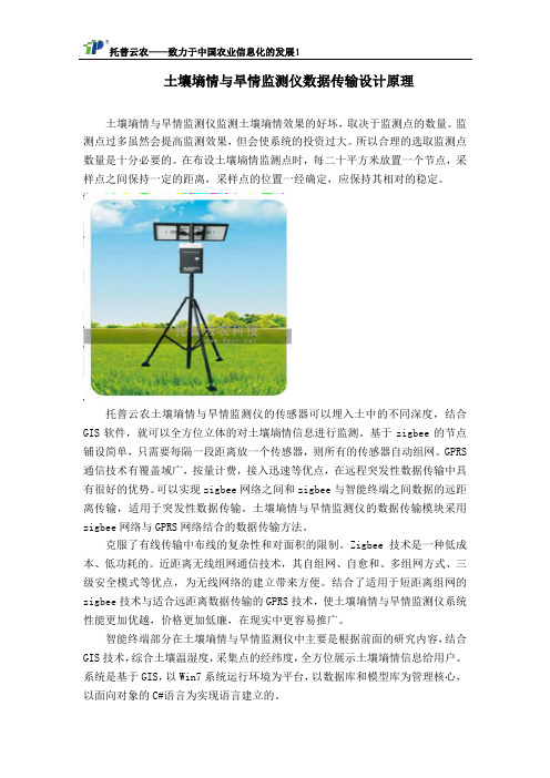
托普云农土壤墒情与旱情监测仪的传感器可以埋入土中的不同深度,结合GIS软件,就可以全方位立体的对土壤墒情信息进行监测。
基于zigbee的节点铺设简单,只需要每隔一段距离放一个传感器,则所有的传感器自动组网。
GPRS 通信技术有覆盖域广,按量计费,接入迅速等优点,在远程突发性数据传输中具有很好的优势。
可以实现zigbee网络之间和zigbee与智能终端之间数据的远距离传输,适用于突发性数据传输。
土壤墒情与旱情监测仪的数据传输模块采用zigbee网络与GPRS网络结合的数据传输方法。
克服了有线传输中布线的复杂性和对面积的限制。
Zigbee技术是一种低成本、低功耗的。
近距离无线组网通信技术,其自组网、自愈和、多组网方式、三级安全模式等优点,为无线网络的建立带来方便。
结合了适用于短距离组网的zigbee技术与适合远距离数据传输的GPRS技术,使土壤墒情与旱情监测仪系统性能更加优越,价格更加低廉,在现实中更容易推广。
智能终端部分在土壤墒情与旱情监测仪中主要是根据前面的研究内容,结合GIS技术,综合土壤温湿度,采集点的经纬度,全方位展示土壤墒情信息给用户。
系统是基于GIS,以Win7系统运行环境为平台,以数据库和模型库为管理核心,以面向对象的C#语言为实现语言建立的。
TZS-GPRS-I土壤墒情与旱情监测仪又可称为无线墒情与旱情管理系统,墒情与旱情信息管理系统,土壤墒情与旱情管理系统,无线墒情与旱情管理系统,土壤墒情实时监测系统。
托普云农土壤墒情与旱情监测仪拥有自己的数据平台(数据无须上传至国家系统)及监测网络,数据可直接发送到管理者的服务器,下级所有被管理站点均可查看。

土壤水分监测系统方案概述一、方案概述:土壤水分可以说是土壤的重要组成部分,而且我们都知道农作物的生长离不开土壤水分。
所以在农作物生长过程中,需要及时并且准确地采集和监测土壤水分含量,因为掌握土壤水分的含量对农作物的生长有着至关重要的作用。
但是,现有的土壤水分测量技术各具特色,但大都只能实现对测量数据的定点定时采集,无法将其与远程控制中心相结合,从而不能对采集到的数据进行实时分析和调控。
基于以上背景,为了达到对土壤水分进行快速准确地采集和实时监测的目的,托普云农特研发生产了一种数据采集远程监测系统,被称为TZS-GPRS-I土壤水分监测系统,采用GPRS传输,可通过短信、电脑等方式进行远程查看数据。
二、系统介绍TZS-GPRS-I土壤水分监测系统能够实现对土壤墒情(土壤湿度)的长时间连续监测。
用户可以根据监测需要,灵活布置土壤水分传感器;也可将传感器布置在不同的深度,测量剖面土壤水分情况。
系统还提供了额外的扩展能力,可根据监测需求增加对应传感器,监测土壤温度、土壤电导率、土壤PH值、地下水水位、地下水水质以及空气温度、空气湿度、光照强度、风速风向、雨量等信息,从而满足系统功能升级的需要。
三、系统原理TZS-GPRS-I土壤水分监测系统采用GPRS传输方式。
GPRS通讯方式是采集点采集数据后通过GPRS上传网络,用户可利用任意一台可以上网的电脑登陆并查看数据,稳定可靠,解决了同行业利用移动无线IP传输通讯经常掉线的麻烦。
数据稳定可靠无需担心突然断线,通讯费用按流量计费,适用于数据量大的应用模式。
四、系统在水稻田的应用分析对于水稻田而言,水分管理需要进行合理的控制,水分过多或过少都不利于水稻的生长。
如果不能及时、足量灌溉,或过量灌溉,都可能导致水稻根茎不能从土壤及时吸收水分,影响水稻的正常生长,由于人工难以在深夜里到田间采集土壤水分数据,因此,通过土壤水分监测系统对土壤水分的相关情况进行监测了解,保证田间土壤水分在一定合适的范围内。
自动土壤水分观测数据传输格式及传输方案自动土壤水分观测数据传输格式及传输方案中国气象局综合观测司预报网络司2009.8目录1上传文件命名规则 (1)1.1单站文件命名规则 (1)1.2多站文件命名规则 (1)1.3上传文件名说明 (2)2 上传时间规定 (7)2.1数据上传原则 (7)2.2数据上传时间规定 (8)3 上传数据格式 (9)3.1 自动土壤水分观测站上传数据格式 (9)3.2 省级打包上传格式 (14)3.3 作物名称编码表 (15)自动土壤水分观测数据传输格式及传输方案为规范自动土壤水分观测和资料传输业务,确保自动土壤水分观测资料及时、高效地收集、共享和应用,制定本数据传输格式及传输方案。
1上传文件命名规则自动土壤水分观测站上传文件是指自动土壤水分观测站上传至省级气象通信部门或国家气象信息中心的数据文件。
自动土壤水分观测站上传文件包括单站文件命名和多站文件命名两种规则。
1.1单站文件命名规则单站自动土壤水分观测站上传文件命名方式为:Z_AGME_I_IIiii_yyyymmddhhMMss_O_ASM-F TM[-CCx].txt1.2多站文件命名规则多站自动土壤水分观测站上传文件命名方式为(通过省级或国家级打包的文件):Z_AGME_C_CCCC_yyyymmddhhMMss_O_AS M-FTM.txt1.3上传文件名说明(1)文件名称各段说明Z:固定代码,表示文件为国内交换的资料。
AGME:固定代码,表示农业气象资料。
I:固定代码,指示其后字段代码为测站区站号。
IIiii:测站区站号。
区站号使用规则见1.3(2)C:固定代码,指示其后字段编码为编报台字母代号。
CCCC:编报台字母代号,详见1.3.3编报台站代码表。
yyyymmddhhMMss:文件生成时间“年月日时分秒”(UTC,国际时)。
其中,yyyy为年,4位;mm为月,2位;dd为日,2位;hh为小时,2位;MM分钟,2位;ss为秒,2位。
在年月日时分秒中,若位数不足时,高位补“0”。
例如:2009年3月3日19时整,编为20090303190000。
O:气象观测数据指示码。
ASM:自动土壤湿度。
FTM:表示定时观测。
CCx:资料更正标识,可选标志,仅在单站资料文件名中使用。
对于某测站(由IIiii指示)已发观测资料进行更正时,文件名中必须包含资料更正标识字段。
CCx中:CC为固定代码;x 取值为A~X,x=A时,表示对该站某次观测的第一次更正,x=B时,表示对该站某次观测的第二次更正,依次类推,直至x=X。
txt:固定代码,表示文件为文本文件。
注:ASM和FTM之间以及后面的“CCx”字段间的分隔符为减号‘-’;其它字段间的分隔符为下划线‘_’。
文件名的大小写敏感。
(2)区站号使用规则自动土壤水分观测站区站号统一采用地面气象观测站的区站号,即安装在国家级气象台站的用该台站的区站号,安装在原区域站的用该区域站区站号,新建观测点按照区域站区站号编制原则新编区站号。
表1 2005年中国气象局对区域站区号的定义区号省(区、市)区号省(区、市)区号省(区、市)区号省(区、市)A0-A1 北京E0-E9吉林M0-M1海南T0-T9云南A2-A3 天津F0-F9福建M2-M9江苏U0-U9西藏A4-A5 上海G0-G9广东N0-N9广西V0-V9陕西A6-A9 重庆H0-H9黑龙江O0-O9河南W0-W9甘肃B0-河北I0-I安徽P0-P湖南X0-X青海B3 9 9 9B4-B9 山西J0-J9江西Q0-Q9湖北Y0-Y3宁夏C0-C9 内蒙K0-K9浙江R0-R9贵州Y4-Y9新疆D0-D9山东L0-L9辽宁S0-S9四川Z0-Z9备用(3)编报台站代号表表2 编报台字母代号(CCCC)CCCC代码编报台名称CCCC代码编报台名称CCCC代码编报台名称BEPK 北京市BECS 长BEXA 西沙安BETJ 天津BENC 南昌BEYC银川BESZ 石家庄BCSH 上海BEXN西宁BETY 太原BENJ 南京BCUQ乌鲁木齐BEHT 呼和浩特BEHF 合肥BCCD成都BEZZ 郑州BEHZ 杭州BECQ重庆BEJN 济南BEFZ 福州BEGY贵阳BCSY 沈阳BCGZ 广州BEKM昆明BECC 长春BEHK 海口BELS拉萨BEHB 哈尔滨BENN 南宁BABJ国家气象中心BCWH 武汉BCLZ 兰州BEDL 大连BEQD 青岛BENB 宁波BEXM厦门2 上传时间规定2.1数据上传原则(1)自动土壤水分观测站内容包括各层土壤的土壤体积含水量、土壤相对湿度、土壤重量含水率、土壤有效水分贮存量气象要素数据;(2)自动土壤水分观测必须按规定时间将观测后形成的数据上传到国家气象信息中心;(3)数据上行传输方法在全国气象宽带网络系统本地通信机上建立相应的户头,参加交换的自动土壤水分观测数据收集到此用户下,并按上述文件名格式命名,同时通过自编ftp自动上载程序,把这些资料打包(更正报不打包)发送到国家级服务器(172.17.1.3)“newopr”账户下的“up”目录中,此账户的口令同自动站上传资料口令。
2.2数据上传时间规定自动土壤水分观测站数据每小时00分01秒至05分00秒生成,并采取有线或无线GPRS/CDMA传输至省级气象局信息网络中心,再由省级信息网络中心将数据打包上传至国家气象信息中心,上传时间规定按下表执行。
表3 自动土壤水分观测上传时间规定每日国际时时限缺报00-23 <=30分钟>1440分钟3 上传数据格式3.1 自动土壤水分观测站上传数据格式每个自动土壤水分观测站上传数据文件<Z_AGME_I_IIiii_yyyymmddhhMMss_O_ASM-F TM[-CCx].txt >为单条记录。
记录的后面(即文件结尾处)加“NNNN<CR><LF>”表示文件结束。
单条记录包括区站号、纬度、经度、地段拔海高度、各层土壤水分层次标示及相关湿度数据共106组,每组用1个半角空格分隔,共486字节;分别记录每小时土壤水分数据。
其排列顺序及长度分配如下表:表4 自动土壤水分观测站上传数据格式表序号要素名长度说明1 区站号5字节5位数字或第1位为字母,第2-5位为数字2 测量地纬度6字节按度分秒记录,均为2位,高位不足补“0”,台站纬度未精确到秒时,秒固定记录“00”3 测量地经度7字节按度分秒记录,度为3位,分秒为2位,高位不足补“0”,台站经度未精确到秒时,秒固定记录“00”4 测量地拔海高度5字节保留一位小数,扩大10倍记录,高位不足补“0”5 测量地段标示4字节“0000”标示固定地段。
作物地段以B电码表(见3.3作物名称编码表)为准,森林采用“2000”标示。
6 观测时间14字节年月日(国际时,yyyyMMddhhmmss),其中:分秒固定为“0000”7 0-10cm土壤层次标示4字节固定输入“L010”8 0-10cm土壤体积含水量3字节单位:g/cm3,保留一位小数,扩大10倍记录,高位不足补“0”9 0-10cm土壤相对湿度4字节百分比。
保留一位小数,扩大10倍记录,高位不足补“0”10 0-10cm土壤重量含水率3字节百分比。
保留一位小数,扩大10倍记录,高位不足补“0”11 0-10cm土壤有效水分贮存量3字节单位:mm。
取整进行记录,高位不足补“0”12 10-20cm土壤层次标示4字节固定输入“L020”13 10-20cm土壤体积含水量3字节同前14 10-20cm土壤相对湿度4字节同前15 10-20cm土壤重量含水率3字节同前16 10-20cm土壤有效水分贮存量3字节同前17 20-30cm土壤层次标示4字节固定输入“L030”18 20-30cm土壤体积含水量3字节同前19 20-30cm土壤相对湿度4字节同前20 20-30cm土壤重量含水率3字节同前21 20-30cm土壤有效水分贮存量3字节同前22 30-40cm土壤层次标示4字节固定输入“L040”23 30-40cm土壤体积含水量3字节同前24 30-40cm土壤相对湿度4字节同前25 30-40cm土壤重量含水率3字节同前26 30-40cm土壤有效水分贮存量3字节同前27 40-50cm土壤层次标示4字节固定输入“L050”28 40-50cm土壤体积含水量3字节同前29 40-50cm土壤相对湿度4字节同前30 40-50cm土壤重量含水率3字节同前31 40-50cm土壤有效水分贮存量3字节同前32 50-60cm土壤层次标示4字节固定输入“L060”33 50-60cm土壤体积含水量3字节同前34 50-60cm土壤相对湿度4字节同前35 50-60cm土壤重量含水率3字节同前36 50-60cm土壤有效水分贮存量3字节同前37 60-70cm土壤层次标示4字节固定输入“L070”38 60-70cm土壤体积含水量3字节同前39 60-70cm土壤相对湿度4字节同前40 60-70cm土壤重量含水率3字节同前42 70-80cm土壤层次标示4字节固定输入“L080”43 70-80cm土壤体积含水量3字节同前44 70-80cm土壤相对湿度4字节同前45 70-80cm土壤重量含水率3字节同前46 70-80cm土壤有效水分贮存量3字节同前47 80-90cm土壤层次标示4字节固定输入“L090”48 80-90cm土壤体积含水量3字节同前49 80-90cm土壤相对湿度4字节同前50 80-90cm土壤重量含水率3字节同前51 80-90cm土壤有效水分贮存量3字节同前52 90-100cm土壤层次标示4字节固定输入“L100”53 90-100cm土壤体积含水量3字节同前54 90-100cm土壤相对湿度4字节同前55 90-100cm土壤重量含水率3字节同前56 90-100cm土壤有效水分贮存量3字节同前57 100-110cm土壤层次标示4字节固定输入“L110”58 100-110cm土壤体积含水量3字节同前59 100-110cm土壤相对湿度4字节同前60 100-110cm土壤重量含水率3字节同前61 100-110cm土壤有效水分贮存3字节同前量62 110-120cm土壤层次标示4字节固定输入“L120”64 110-120cm土壤相对湿度4字节同前65 110-120cm土壤重量含水率3字节同前66 110-120cm土壤有效水分贮存3字节同前量67 120-130cm土壤层次标示4字节固定输入“L130”68 120-130cm土壤体积含水量3字节同前69 120-130cm土壤相对湿度4字节同前70 120-130cm土壤重量含水率3字节同前71 120-130cm土壤有效水分贮存3字节同前量72 130-140cm土壤层次标示4字节固定输入“L140”73 130-140cm土壤体积含水量3字节同前74 130-140cm土壤相对湿度4字节同前75 130-140cm土壤重量含水率3字节同前76 130-140cm土壤有效水分贮存3字节同前量77 140-150cm土壤层次标示4字节固定输入“L150”78 140-150cm土壤体积含水量3字节同前79 140-150cm土壤相对湿度4字节同前80 140-150cm土壤重量含水率3字节同前81 140-150cm土壤有效水分贮存3字节同前量82 150-160cm土壤层次标示4字节固定输入“L160”83 150-160cm土壤体积含水量3字节同前84 150-160cm土壤相对湿度4字节同前86 150-160cm土壤有效水分贮存量3字节同前87 160-170cm土壤层次标示4字节固定输入“L170”88 160-170cm土壤体积含水量3字节同前89 160-170cm土壤相对湿度4字节同前90 160-170cm土壤重量含水率3字节同前91 160-170cm土壤有效水分贮存量3字节同前92 170-180cm土壤层次标示4字节固定输入“L180”93 170-180cm土壤体积含水量3字节同前94 170-180cm土壤相对湿度4字节同前95 170-180cm土壤重量含水率3字节同前96 170-180cm土壤有效水分贮存量3字节同前97 180-190cm土壤层次标示4字节固定输入“L190”98 180-190cm土壤体积含水量3字节同前99 180-190cm土壤相对湿度4字节同前100 180-190cm土壤重量含水率3字节同前101 180-190cm土壤有效水分贮存量3字节同前102 190-200cm土壤层次标示4字节固定输入“L200”103 190-200cm土壤体积含水量3字节同前104 190-200cm土壤相对湿度4字节同前105 190-200cm土壤重量含水率3字节同前106190-200cm土壤有效水分贮存量3字节同前存储要求:①若要素缺测或无记录,记录土壤层次标示,其余则均应按约定的字长,每个字节位均存入一个“/”字符;②要素位数不足时,高位补“0”。